
The Preliminary Risk Assessment was designed to identify the potential risk sources, pathways, and receptors for soil contaminants on the Lower Botanic Gardens, Belfast. This was achieved through desk-based research into the local current and past land usages, and subsequent potential historical or geogenic contaminant legacies. This investigation format adheres to the UK government LCRM Stage 1 risk assessment guidelines (Environment Agency, 2021a).
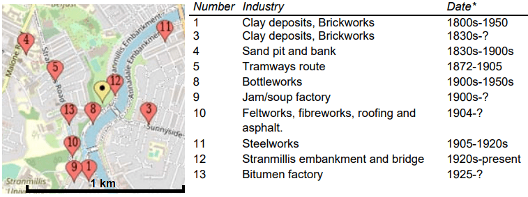
Currently, the site is an undeveloped turfed plot in the Lower Botanic Gardens public park, adjacent to the River Lagan, used by dog walkers, students, and the general public. There are no waste permits (DAERA, 2021a) or ecological considerations (DAERA, 2021b) on or near the site, though there are industrial discharge consents upstream on the river (DAERA, 2021c). Historically, the site has remained largely undeveloped since records began in 1832, with the exception of landfilling during the Stranmillis Embankment on the E border (1920s) and a row of post-war housing on the E border (1945-1971) (Department for Communities, 2011). The surrounding area is now largely residential, however, there have been multiple potentially polluting past industries proximal to the site. These include local clay and brickworks, tramways route, bottle-works, and a bitumen factory (Figure 1).
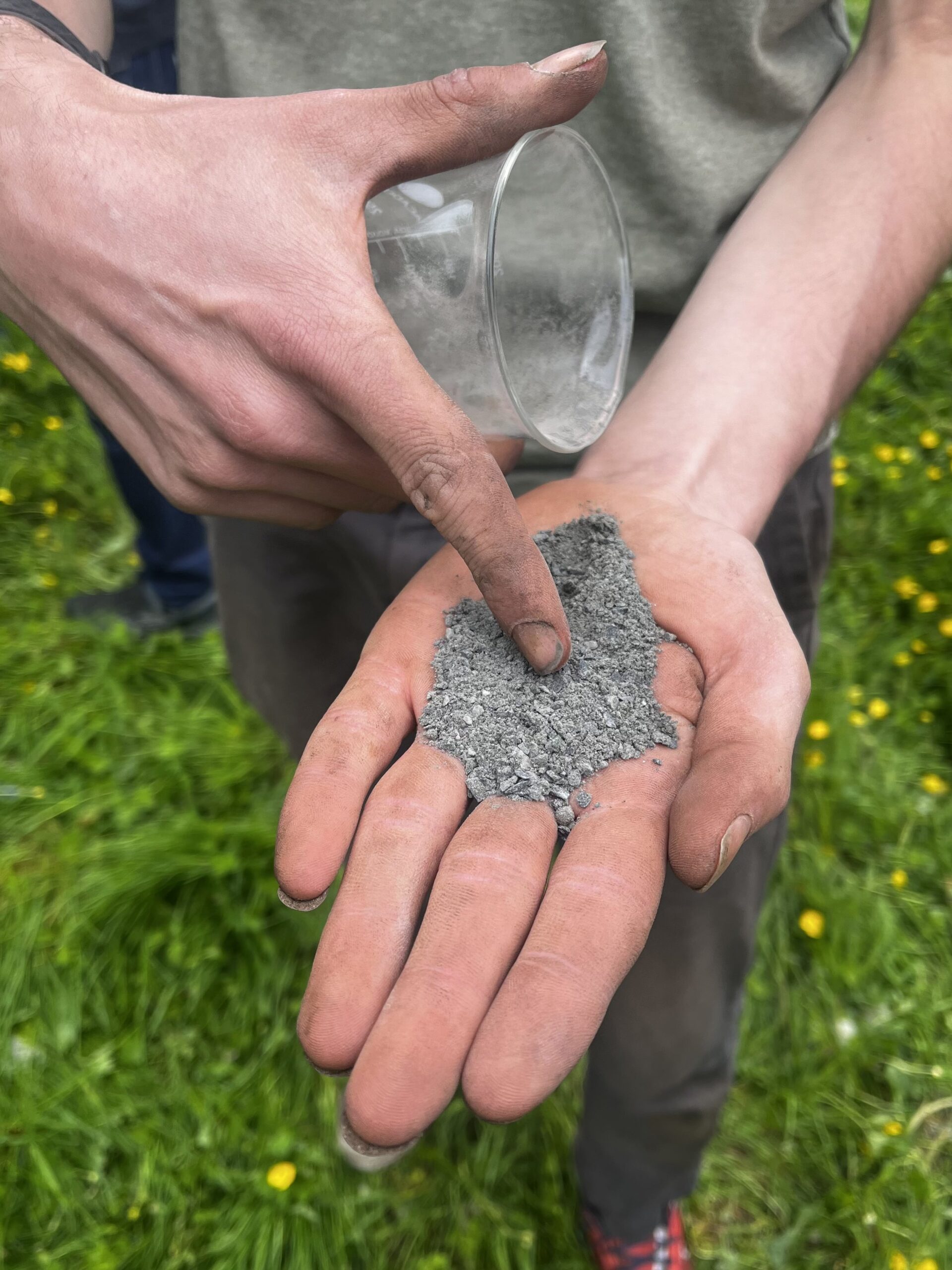
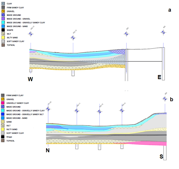
Site geology comprises 300m-thick fine-medium grained Sherwood sandstone bedrock and overlying glaciofluvial till and boulder clays to the W, and tidal flat deposits to the E (Department for the Economy, 2020) (Figure 2). Kirk McClure Morton (2003) also identified made ground/infill surface substrates in a previous onsite investigation. Chemical analysis of previous borehole data reported high concentrations of lead, polycyclic aromatic hydrocarbons, petroleum hydrocarbons, acid soluble sulphides, and CO2 ground gas emissions (Kirk McClure Morton, 2003; Glover Site Investigations Ltd, 2008). The proximal River Lagan and underlying Sherwood Sandstone and alluvium aquifers are rated ‘poor quality’ and may also hold potential soil contaminants (Belfast City, 2020).
The combination of current and historical land uses and geological contaminant sources, possible pathways of contamination, and likely site users then indicate the potential for contaminant exposure and risk on the site. This is summarised in the conceptual site model. Here, inhalation of airborne particulate matter and released ground gases, and ingestion of soil particles or contaminated plant matter may pose the most significant risks onsite. Lesser risk is associated with dermal contact of site soils and plant matter, and very little risk is associated with ingestion, inhalation, and direct contact with contaminated soil dusts by offsite receptors; the influence of bedrock geological contaminants; and groundwater and surface water contaminant migration. Finally, it was concluded that further investigations will be required to establish the current distribution and concentrations of contaminants onsite in preparation for site development.
References
Armstrong, E. 2022. MEng student paper. Assessing the Risks posed by Land Contamination at Lower Botanic Gardens, Belfast. Queen’s University Belfast. Unpublished. (Accessed 21 May 2022)
Belfast City (2020) Local Development Plan 2020-2035. Available at: https://www.belfastcity.gov.uk/getmedia/d37dfcf8-f59e-428f-b558-71ae9a3abf37/POP024_TP-Env.pdf (Accessed 25 November 2021).
DAERA (2021a) Exemptions from Waste Management Licensing. Available at: https://public-registers.daera-ni.gov.uk/waste-exemptions (Accessed 22 November 2021).
DAERA (2021b) NIEA Natural Environment Map Viewer. Available at: https://appsd.daera-ni.gov.uk/nedmapviewer/ (Accessed 22 November 2021).
DAERA (2021c) NIEA WMU Water Information Requests Map Viewer. Available at: https://gis.daera-ni.gov.uk/arcgis/apps/webappviewer/index.html?id=7e234827aa7a405d990359aa92c7c287 (Accessed 22 November 2021).
Department for Communities (2011) Historic Building Details. Available at: https://apps.communities-ni.gov.uk/Buildings/buildview.aspx?id=9467&js=false (Accessed 23 November 2021).
Department for the Economy (2020) GSNI GoIndex. Available at: http://mapapps2.bgs.ac.uk/GSNI_Geoindex/home.html (Accessed 24 November 2021).
Environment Agency (2021a) Guidance: LCRM: Stage 1 risk assessment. Available at: https://www.gov.uk/government/publications/land-contamination-risk-management-lcrm/lcrm-stage-1- risk-assessment#tier-1-preliminary-risk-assessment (Accessed 22 November 2021).
Glover Site Investigations Ltd (2008a) Lyric Theatre Replacement, Ridgeway Street, Belfast. Lyric Theatre. Ref: 08-0272.
Kirk McClure Morton (2003) Contaminated Land Survey Final Report. Queen’s University Belfast. Ref: 5460.09/Reports.
Newell (2022) Preliminary Risk Assessment Lower Botanic Gardens, Belfast [Internal report]